سایت کتاب دانشگاه همراه همیگشی شما تا رسیدن به هدف

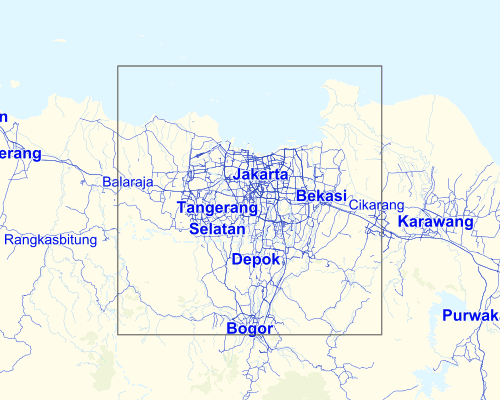
jakarta
اینها فایلهای DXF دو بعدی عظیم و ساده از شبکه های جاده ای کلانشهر هاست که شامل 3 سطح به عنوان polylines است.
Instant CAD files for any location on earth
Around the World
Paris
Copenhagen
Hong Kong
London
Designers, Architects, and Illustrators can save hours of drawing No subscription required
How It Works
Define any map area
Download a layered drawing file
Building height information is available in some locations.
Edit and render in your design software
WORKS BEST WITH
AutoCAD
Rhinoceros 5
SketchUp…